


Stiperstones, Black Rhadley Hill and Linley Hill from Snailbeach
Published on November 10 2018
Murky, misty morning followed by picturesque landscape and sweeping views.
Summits: Stiperstones x2, Black Rhadley Hill and Linley Hill
|
Stats:
Length: 23.1 km
Duration: 5:59:05
Ascent: 906 m
Max Elevation: 526 m
Min Elevation: 199 m
Date: 10/11/2018
Difficulty: Medium
Terrain: Wooded trail, uneven
rocky paths, grassy fields and
country lanes.
|
Equipment:
Shoes: Meindl Toronto GTX
Trousers: Dare 2b tuned in zip off trousers
Base Layer: RAB Merino+ 120 LS Tee
Mid Layer: Freedom Trail Idaho Fleece
Soft Shell: RAB Microlight Alpine
Hard Shell: Arc'teryx Zeta LT Rain Jacket
Bag: Deuter AC Lite 18
Poles: Freedom Trail Walker Pole
Camera: Sony Cyber-shot DSC-WX350
Other: Higear Trekker Gaiter
|
The Stiperstones is a walk with a difference; it has spectacular views out across the Shropshire Hills and into Wales, but it also has some fantastic opportunities for clambering and rock hopping. How long this ridge will take depends on your enthusiasm for climbing. You could make this walk shorter and circular by starting at either of the other two car parks; The Bog town hall or the car park by Knoll's farm. Then walking along the behind of the Stipperstones, before cutting back and along the top at The Hollies. This way you will cut out 6 or 7 km but you will miss the old lead mine and Crowsnest Dingle.
Walk Description
The weather this weekend was looking all over the place. I had originally planned a walk for Sunday but as the week wore on it seemed as if Saturday morning might be the better option. Nicky was working this weekend, so to get the best of the weather, I decided to wake up with her. I picked up some lunch from Lidl at 8am, as it opened, before continuing on my way to Snailbeach.
The drive to Snailbeach from Shrewsbury is very pleasant, passing through 3 quaint little villages; Hanwood, Pontesbury and Minsterley. The autumnal colours of the surrounding countryside look spectacular in the morning light, and the sight of Pontesford Hill and Earl Hill poking above the hedgerows looked oh, so tempting. I'm always amazed driving past that I am still yet to walk them. Most people walking the Stiperstones start at either The Bog or the car park by Knoll's Farm. I personally prefer starting at Snailbeach as I enjoy exploring the old mine and the walk around Crownsnest Dingle.
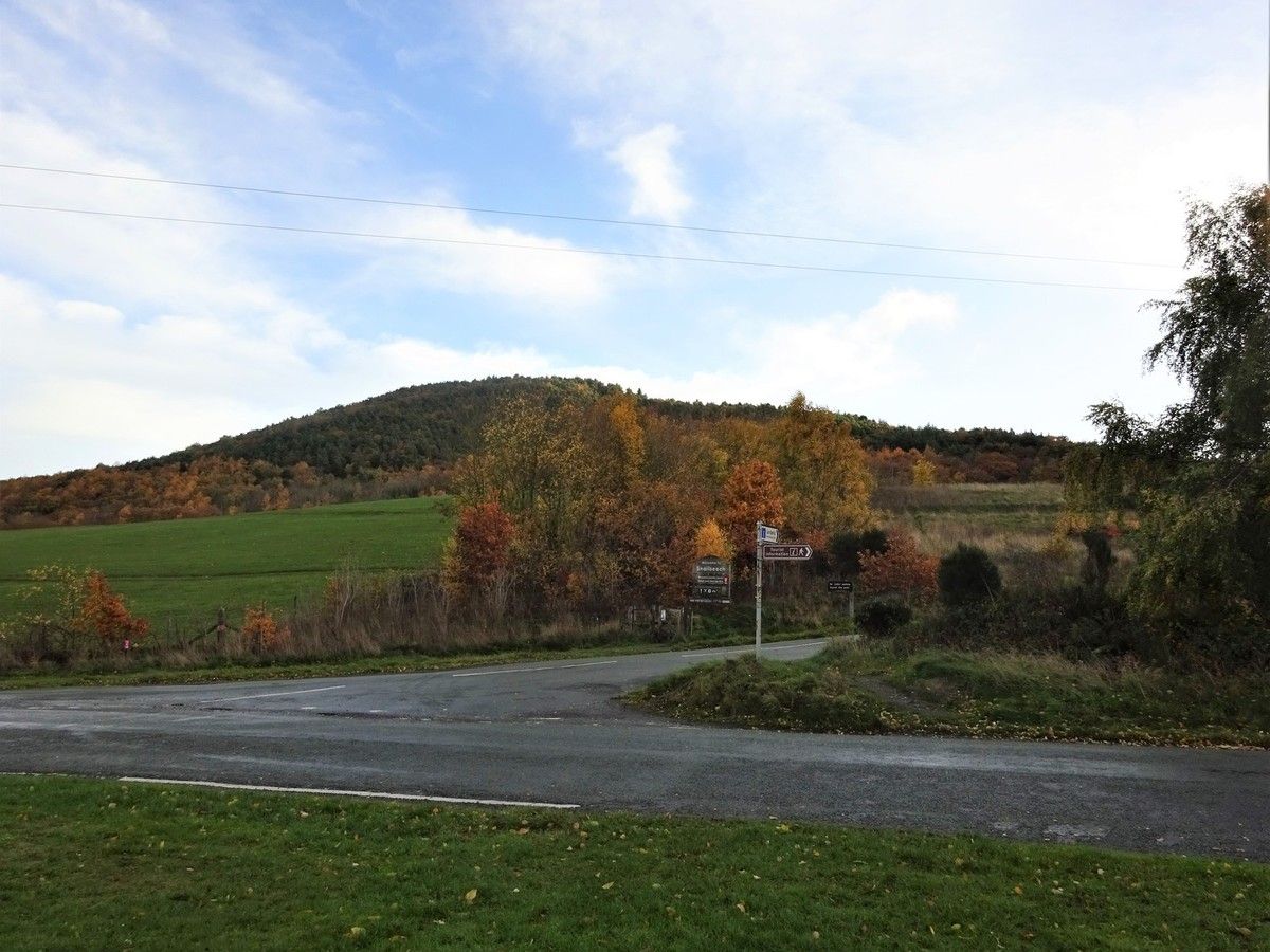
From the town hall car park, I cross the road towards the coppery coloured trees and head through the gate beneath the sign, welcoming me to Snailbeach. This trail runs parallel to the road and takes me up the hill, passing our first ruin from the old lead mine. At the top of the track, I go through the little gate and follow the road a short distance towards the back of the mine, where I turn off on to a track which leads me past the old Compressor House.

After the Compressor House there is a lovely view looking down over the valley, back towards Minsterley. This layer of the mine also includes the Crusher House, the old shaft down to the mine (George's Shaft) and a Blacksmith's shop. After a little explore, I went up the steps following the sign to the pumping house. The steps take me up past the Inspection Tunnel to the Engine House. Next to the Engine House there is an old shaft that has been covered over by a metal grate. I slipped a small stone though one of the holes in the grating and listened for the splash as it hit the bottom of the shaft; it's a long way down!

Following the path past the Engine House and turning up the hill, I could see Resting Hill Chimney through the trees. I followed the signs towards it and had a little scout around the bottom before heading back to the path. I continued up the hill, through the sparsely covered trees, to the gate leading to a grassy field. This section is quite steep, but other than a few slippy leaves it is easy going underfoot.

The view looking back, as I made my way up the field, is quite spectacular. To the north I could make out Resting Hill Chimney poking out through the bronze and green trees. Panning across the patchwork plain to the west I could see the silhouettes of the Cambrian Mountains, stretching between the Brecon Beacons and Snowdonia. Looking south west I could make out Corndon Hill jutting out above the undulating Shropshire Hills. Once up the steep climb along the field, the path flattens out significantly, it is quite a windy day today and the air is filled with the rustle of leaves from the surrounding trees. I pass through the gate at the end of the field glance over the sign welcoming me to the Stiperstones. I follow the path around the edge of the deep wooded dell called Crownsnest Dingle.

Crowsnest Dingle is the reason I start my Stiperstones walks at Snailbeach, rather than the The Bog. I really enjoy walking the edge, and it looks particularly majestic on a wonderful autumnal day such as today. The warm hues of brown, orange and green add to the rough texture of the dingle, it looks as if a ragged woollen rug has been draped across the hillside. The small narrow path running around the top of the dingle joins up with main path, that takes me up along the top of Stiperstones.

I see my first Stiperstone of the day, Devil's Chair, just as the morning mist starts rolling in from the west. I get a few minutes of views across the plain before I pass Sheperd's Rock, and the fog completely closes in and the visibility dramatically reduces. As I approach Devil's Chair, the path become rocky and difficult under foot. With the mist and the rugged terrain, I am reminded of Frodo and Sam making their way across the Emyn Muil Mountains trying to find their way to the Dead Marches, although I am pretty certain there is no Gollum following me.

I'm not one to shy away from away from a good climb, and once I reach Devil's Chair, I shoot straight up to the top before making my way along the craggy ridge. The wet conditions make it quite slippy under foot, meaning I have to edge my way along the rocks slower than I normally would. There are a few difficult sections but mostly it is quite easy climbing, even with the minimal grip under foot. Once off Devil's Chair I make my way back to the main path and head towards the next Stiperstone, and highest point of this walk, Manstone Rock.

There is a good scramble up to the trig point and normally some great views, although this morning the view was restricted to no more than 50 m. With no landscapes on display for photographing, I decided to take a selfie at the trig point instead, to celebrate my first summit of the day. From Manstone rock I continued on the rocky path of the Stiperstone ridge, over Cranberry Rock and out of the Stiperstone nature reserve. Despite being out of the reserve there are still more Stiperstones to come, and with the mist starting to lift, the rest of the day is looking up. Going straight out of the reserve and across the road, I follow the path across the field by Upper Knolls farm and through the woods at the end. Once through the woods is the Nipstone nature reserve and the conclusion of the Stiperstones. As I walk along the reserve Nipstone Rock is to my right jutting out of the heather. On my left, and blocking my route forward, is a small herd of cows enjoying some tasty mouthfuls of grass. After a slight stand off, I slip past and continue on to The Rock, the last of the Stiperstones.

The path sweeps around to the left of The Rock, but I cut away to the right along a narrow track that leads off towards a little lane. I follow this lane along to the south towards Black Rhadley Hill. To my left I can see a red flag flying signalling that the shooting range is currently active, not that I needed warning, I can hear the shots firing off as I make my way along the lane. Where the lane bends round to the left there is a gate that takes me to the start of Black Rhadley Hill, I follow the path up to the top of the hill, pausing part way to look back along the Stiperstones. Personally I think this is one of the best views of the Stiperstones as you get a real appreciation of the sheer edge of The Rock. The festive flora lining the path is comprised of a fantastic array of fiery crimson colours, which contrasts superbly with the bright yellows and oranges splattered across the surrounding landscape.

The 360 degree panoramic view from the top of Black Rhadley Hill is absolutely stunning even with the overcast sky. Behind me I can see back across the entire craggy ridge of the Stiperstones, to my right Corndon Hill stands proud dwarfing its surrounding countryside, and in front of me is the West Onny river flowing along it's grassy green valley, flanked by Heather Mynd and Linley Hill. This was definitely one of the hidden gems on this walk, which I hadn't expected when I originally started out. From the top I headed down, what looked like an old vehicle track, heading due south. This first part of the decent is quite steep, but it flattens out where it meets a small path traversing across the hill, passing under a beautifully coloured little tree.

I pass through the wooded section covering the bottom of Black Rhadley Hill. The trees are now just sparsely covered, and I can make out the outline of Linley Hill across the valley through the spindly branches. At the bottom of the hill, my path turns to the right running alongside the lane that skirts around the base of the hill. There is a small wire fence running between the lane and my path, I find a gate that leads through the fence. Going over the little wooden panel on the fence across the lane takes me onto a field. This leads down to the path running along the river West Onny.

This is a very pleasant path to walk along, the walking is easy and the views both back and forward along the river are fantastic. I approach a fields with a few cows dotted around, and I take a little detour to inspect an old rickety bridge. The handrail along the bridge is hanging on by a thread ,and where the bridge meets the far side of the river it seems to have slipped down from the top of the bank. I climb up the bridge to the edge of the river bed to get a better look, but I don't venture out over the water. Returning to the path, I continue down the valley and my mind turns to lunch. Today I have two goats cheese and sun dried tomato focaccias and two scotch eggs. I decide to eat whilst walking as it is easy going underfoot. The path crosses the river twice over two elegant, but simple stone bridges, which thankfully are far more stable that the rickety one from earlier.

I stop in the middle of the second bridge to enjoy the last of my focaccia (I decide against having the scotch eggs as well). I look back towards Black Rhadley Hill and admire the patchwork of colours from the trees lining the grassy fields along the valley. From here the path takes me away from the river up towards Linley Hill. At the top of the little lane there is a gate opening on to a field to my left, I take the gate and head up the hill along the tree line. There is a second gate part way up, taking me through the hedge line dividing the field, this gate has been tied shut by a number of knots so I decide to climb over rather than faffing around. Once out the fields I walk along the lane at the top of the fields for about 20 meters before turning off onto the path to the right, I follow the signs for the Shropshire way up through the trees and out onto the grassy, sheep filled fields that cover the top of Linley Hill.

The path is lined by a double row of beech trees, these were planted back in the 18th century by Robert More the MP of both Bishops Castle and Shrewsbury. Sadly, when I went through a number of the trees were now lying across the path, no longer the proud sentinels from years gone by. Reaching the end of the beech trees, I spotted my first fellow walkers of the day, a lady and her dog. Walking along the ridge of the top of Linley Hill reveals some great views over the Shropshire Hills. I can see across to the Long Mynd stretching along the horizon on my right, ahead is the Stiperstones signposting my route home, to my left is Corndon Hill the focal point of where Wales has encroached on the English Boarder, and behind me is Heath Mynd, with a scattering of yellow amongst the green trees skirting around its base.

Where the Shropshire way sweeps off down the hill, I continue along the ridge across the field, before heading to the left in the next field, towards a little wooden section in the fence which I climb over. It is a steep decent down the next field towards Cold Hill farm. To get to the lane on the other side of the farm I make my way through, what seems like somebodies garden and through a gate. Here I meet a little dog that has a good bark at me, whilst I struggle with the gate that I have just passed through. Once away from the dog, I travel a short distance east along the lane, before taking the first path to my left. This path leads up through the fields and runs along the side of the hill, but despite my tired legs, I can't say no to a good hill so I climb to the top to walk along the ridge.

The path then cuts across the ridge, but I continue on straight, around the back of Knolls farm, alongside the dell that runs to my right hand side. The countryside around here is spectacular, but is ruined slightly by the sight of Knolls farm, it looks as if it is being used as a dumping ground around the back. Continuing on I pass through a herd of cows, and a lovely big pile of manure, before heading along the road a short distance to the car park at the bottom of the Stiperstones. From here I head up the hill towards my path from this morning, now no longer covered in fog but instead bathed in beautiful sunshine.

I follow the ridge to Manstone Rock where I climb up to the Cairn for the second time today. The rocks are still a bit slippy but the view is transformed. I take a few minutes to appreciate the distance I have travelled so far today, along the top of the Stiperstones from Snailbeach, heading off via Black Rhadley Hill and back via Linley Hill. It seems like a long way when viewed like this, and I still have a few kilometres yet to travel. My legs are definitely feeling it and the uneven surface certainly doesn't help. I make my way past Devil's Chair, this time along the path rather than climbing across the rocks, and down to Shepherd's Rock. The path evens out a bit here, which is fantastic news as I am starting to get some pain in the back of my knees.

Looking out to my right I can just about make out the silhouette of the Wrekin, standing out on its own towards Telford, and the Lawley just poking its head out above the Long Mynd. I continue back down, around Crownsnest Dingle which is still as vibrantly coloured as it was this morning. I cross the fields, and see the reassuring sight of Resting Hill Chimney, a beacon to guide me back to my car. I head down the steep slope that takes me back into the woods, pausing to take one last look at Corndon Hill and the view across Shropshire and into Wales.

The path steepens, and as the woods close in around me the leaves underfoot become a bit slippy. However, it is not long before I am past Resting Hill Chimney and the Upper levels of the Mine, and heading down the stairs towards George's Shaft. Rather than walking around along the road, I take a shortcut via the stairs next to the old shaft and head to the gravel track that leads back down to the car. Today has been a long but lovely day, the sight of the village hall and a chance to rest my legs is a definitely very welcome, although I still pause for one last glance up the hill to see Resting Hill Chimney peeking out above the trees.
